Weather situational awareness
See every threat.
Warn the right people.
Shear brings radar, satellite wildfire detection, and National Weather Service warnings onto one live map — then alerts the right people on every channel the moment something threatens your area.
Radar · GOES satellite fire detection · NWS warnings · multi-channel alerting
Detail & timing
Every warning in full — and who's in its path
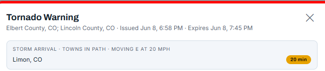
Open any product to its complete text, version history, and impact-based hazard tags. Shear also projects each storm forward along its motion — so you see the towns in its path and a live countdown to arrival, updating as the cell moves.
Explore the features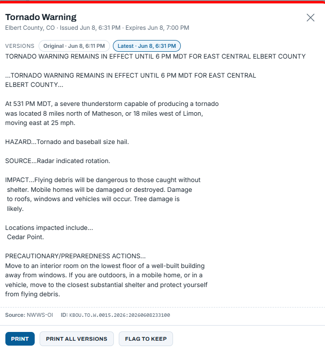
See it
One console for every weather threat
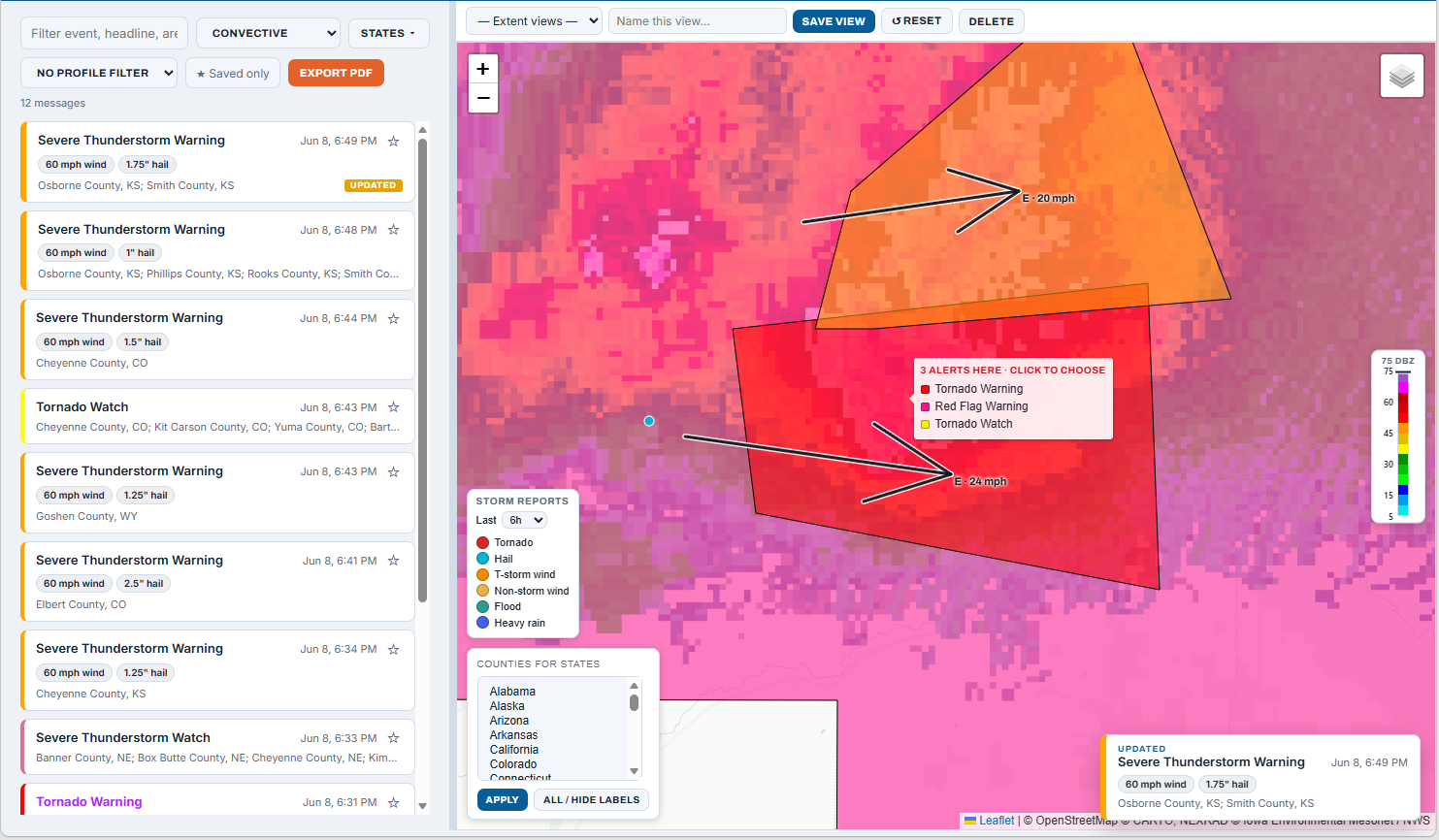
Stop juggling tabs and apps. Radar, satellite fire detection, and live warnings on a single map — your complete weather picture in one view.
Radar
WSR-88D and TDWR plus the national mosaic — the sites you choose, on an interactive map with a reflectivity read-out under your cursor.
Satellite wildfire detection
GOES-based NGFS hot-spots with fire radiative power and detection time — you see ignitions as they are spotted from space, not hours later.
Warnings, motion & arrival times
Warning areas matched to your jurisdiction and drawn in the official NWS colors — with storm-motion vectors and live per-town arrival countdowns, so the threat and its timing are obvious.
Live alert stream
Every qualifying product the moment it is issued — searchable and scoped to the states you cover, with the area, headline, and instructions in one place.
Act on it
Warn the right people, on every channel
Build profiles by product, county, and forecast office — then route each to the contact groups and channels that should hear it. One alert, fanned out everywhere at once.
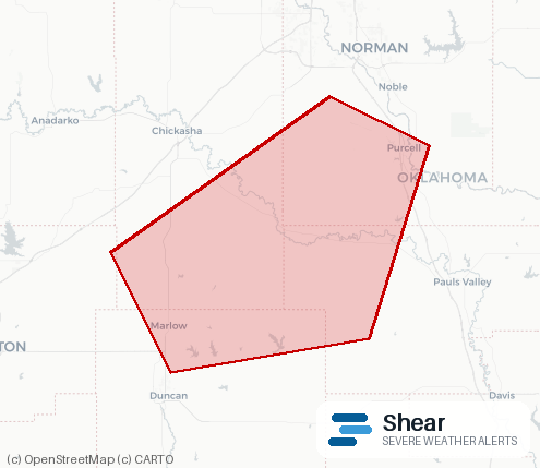
Every alert carries the headline, the instructions, and a map of the affected area.
How it works
Watch, match, warn
your profiles
Watch everything
Radar, satellite fire detection, and the NWS wire all feed one live console — your complete weather picture, always on.
Match in seconds
The instant a qualifying threat appears, Shear matches it against the products, counties, and offices each of your profiles cares about.
Warn the right people
Matched alerts fan out to every selected channel at once — with the area and instructions — and land in the console.
Who it's for
Built for any team that acts on the weather
Emergency management, fire and wildland, public safety, utilities, campuses, ports, and operations teams — anyone making weather-driven safety decisions.
See Shear on your area
We'll bring up radar, satellite fire, and live warnings for your region and show you exactly how an alert would flow to your people.
Request a demo